RACHGOUN
The
Phoenicians provided the North-African coast with dozens of strongholds and
anchorage places. One of them was called Rašgun or Akra. Nowadays it is named
aš-šakur or Argikule.
Ps.Scylax
(111) mentions in the 4th century BC: “facing the river (=Sigi), the
island of Akra , a large city and a harbour”. This must be the island
of Rašgun , distant 1700 metres from
the shore in front of the river Tafna in western part of Algeria . The
island rises 64 metres above the sea. The source of Ps.Scylax – the writer
assembles information from others – only translates the first element of the
toponym, since Rašgun appears as a corrupt form of Ra’š-šigan (Cape of Siga ). Originally this was the name of
the promontory of the Moorish Tower that protects the mouth of the Tafna river
from the northeast. Phoenician-Punic remains contemporaneous of the insular
settlement were found there and suggest an early occupation of the site by
people living on the island. In the course of time the name of this cape (Akra)
was extended to the island. The real Phoenician name of the island could have been
’y-r’š-sgn (=island of the majestic cape). This would be the same as Rusguniae
(Cap Matifou in the middle of Algeria ).
The Phoenicians are using sometimes the same name for different places. The
only site on the island that could be regarded as a harbour is a creek the
water-plane of which measures 20 by 15 metres that is accessibly by a channel
only 1.8 metre large and 0.6 metre deep. This recess on the seashore looks like
an ancient Phoenician “cothon”. These small measures are not exceptional. In
Motya and Toscanos we see comparable measures for the “cothon”. Only small
boats could in this way reach the island. Greater ships must have been
anchoring in the mouth of the river Tafna. Excavations in the “Necropolis of the
lighthouse” have uncovered both cremation and inhumation burials with early
Punic material, witnessing also connections with the Phoenician settlements on
the Iberian Peninsula . There were 114 graves
uncovered. Memorial stones (with inscriptions) are lacking. Jars with shoulder,
funerary urns, dishes with a large rim, datable to the 7th century
BC, were found mixed with handmade pottery, abundant in this burial context. On
a scarab we find the hieroglyphs nb nfr sw (-shou, son of Râ) from the 7th
century BC. The graves also yielded a number of weapons, like spearheads,
amulets and silver jewellery from the 7th-6th century BC.
Child burials were found as well: the small bodies were placed in natural
cavities of the rock, the head always covered with a large stone. This habit
has a similarity with some burials in Phoenicia where the diseased got a
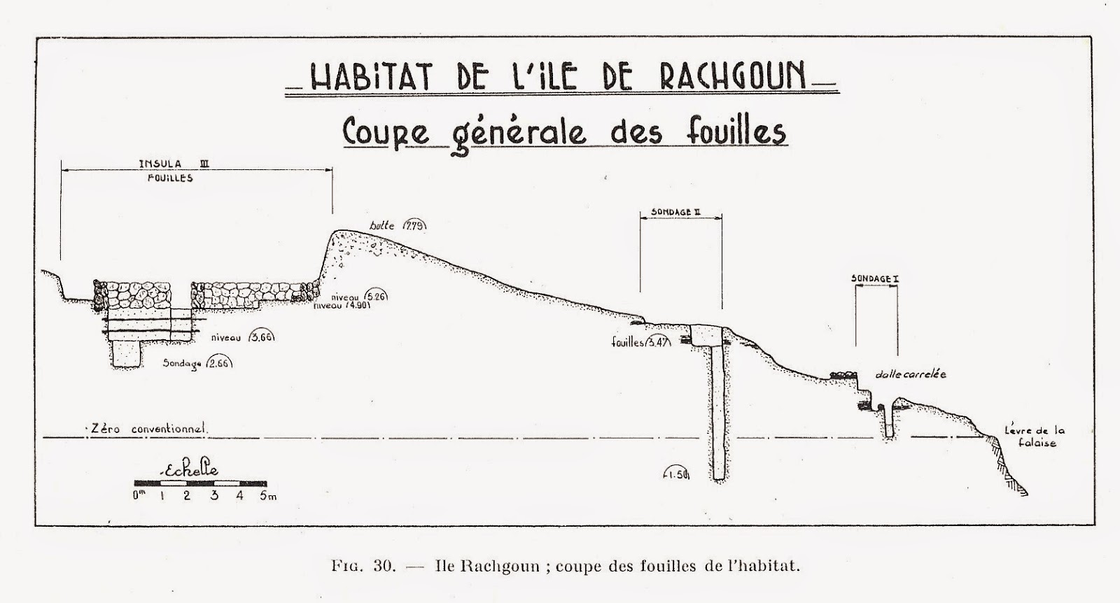
golden plate on the mouth. Soundings in the southern part of the island
uncovered parts of dwellings, coarsely built in roughly broken rubble-stones
bonded in mortar. Most walls were 0.50-0.55 metre thick and the preserved
height hardly exceeded 0.50 metre. It was not possible to establish the plan of
an entire house, but a disposition of rooms in file was observed, as well as the
presence of windows and benches in stone. The use of baked bricks was limited
for clay had to be brought from the mainland. No sanctuary or tophet was found
on the island so far. For the water supply one was dependable on boats coming
from the mainland, or the residents used the water from cisterns on the
northern edge of the island. Like in the cemetery, the oldest material can be
dated from the mid 7th century BC, while nothing seems to postdate
the first part of the 5th century BC. For some unknown reason at first sight, the
settlement was then abandoned. Some occupation traces might remain in parts of
the island which have not been investigated. When ps.Scylax refers to a large
town it seems he got his information from an early 5th century BC
source. However, fragments of Punic amphorae from the 5th century BC
found on virgin soil, indicate that the use of the river-harbour at Siga on the
river Tafna started in the final occupation period of the Rachgoun Island .
The situation on the mainland must have felt save enough for the residents of
the island in order to move to the river-harbour, which was called Takembrit in
this period.
See: G.Vuillemot,
Réconnaissances aux échelles puniques d’Oranie, Alger, 1962.
See :
E.Lipinski, Itineraria Phoenicia ,
OLA 127, Studi Phoenicia
XVIII, Leuven , 2004.
Geen opmerkingen:
Een reactie posten